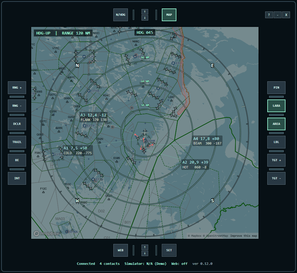
Tactical picture
Ownship, nearby simulator traffic, target symbols, trails, bearing, range, altitude difference, aspect and closure.
Virtual Tactical Situation Display
VTSD is a Windows application for simulator pilots. Track nearby traffic, inspect tactical labels, manage an in-display kneepad and mirror the display to a tablet on your local network.
Simulator use only — not for real-world aviation or operational decisions.
Built for simulator flying
Ownship, nearby simulator traffic, target symbols, trails, bearing, range, altitude difference, aspect and closure.
Built-in Demo mode, Microsoft Flight Simulator through SimConnect, X-Plane 12 Web API and legacy XPUIPC.
Active V-LARA reserved airspace boundaries and a user-defined bullseye with bearing and range.
Multi-page mission text, imported images and persistent WebView2 URL pages inside the tactical display.
A synchronized map and tactical canvas for another device on your local network through the built-in web display.
Nearby contacts can receive callsign metadata from the official public feed while flight data remains simulator-sourced.
Download the latest GitHub release, run TacticalDisplay.App.exe and select Demo, MSFS, XPlane 12 or Xplane Legacy as the data source.